Thursday, April 26, 2012

911 in local news

http://www.tamatoledonews.com/page/content.detail/id/512280/Tama-County-emergency-radio--communications-set-for-change.html?nav=5006

Tama County emergency radio communications set for change

April 25, 2012
By John Speer - Editor , Toledo Chronicle, Tama News-Herald
Will a federal change ordered for radio communications affect Tama County emergency and law enforcement systems?
According to Federal Communications Commission information, "narrowbanding" of radio frequencies was ordered in 2004 by the end of 2012.
What that means is changes need to be made to most two-way radios currently used by fire departments, ambulance services and law officers by the end of this year to comply.
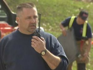
Ryan Currens, Tama County Emergency Management coordinator and E911 Communications director, said last week they will find out this summer.
"There's no firm information, yet," Currens said, because the changes await actually being done.
That's not to say officials are not on top of it.
The Tama County E911 Board recently approved a $108,000 contract with RC Systems, Waterloo. It will pay for re-programming much of the radio equipment. Currens said. Fortunately a lot of the radios are new enough to be adapted to the requirements he said.
Unanswered is whether the change will provide "the punch," Currens said.
"We all know 99.9 percent of our fire (department) and ambulance service members are volunteers," Currens said. Will the new signals reach through to activate radio pagers "without a loss of signal" is the question, he said. There are 12 volunteer fire departments, seven ambulance services and two first responder units serving the county.
Out-of-doors, the pagers likely will work well according to Currens. Indoors, will the signals carry the strength to penetrate walls is yet to be fully determined.
Currens said it is known a paging link for Dysart is needed. That has been provided for already at a cost of about $7,000.
The rest of the existing transmission system, which includes towers at the Courthouse in Toledo, Tama County Shop north of Toledo and at Gladbrook, Traer, Vining and Montour, will continue to provide the basis for the radios as it does now.
Once the narrowbanding is done, the system can actually be put to the test, Currens said. Then, if more links are needed, they can be added, he said.
It is now planned to make the changes in August, work which will take at least a couple of days. Currens said the initial plan was to make the switch in July.
However, with RAGBRAI (Register's Annual Great Bicycle Ride Across Iowa) crossing the Tama County in late July with up to 20,000 bicyclists and support people, it was decided to delay the change in case the system proved unreliable, Currens said.
In addition to the fire and ambulance services, the Tama County Sheriff's Office and police in Toledo, Tama, Meskwaki Settlement and Dysart, the Tama County Highway Department and Conservation Service and city radios systems are among those affected by the change, Currens said.

911 in local news

http://www.tamatoledonews.com/page/content.detail/id/512285/-10-4--is--10-42---Emergency-radio-speak-changes.html?nav=5006

“10-4” is “10-42”- Emergency radio speak changes

April 25, 2012
By John Speer - Editor , Toledo Chronicle, Tama News-Herald
If you're old enough to remember Broderick Crawford on 1950s television "Highway Patrol" (hey, it now airs on This TV at 5 a.m. most days, and 11:30 a.m. on Sundays) you know the "10 Code." Or, if you've ever touched a CB radio you know some "10-Code." Same for listening to police scanners- you know the "10 Code."
If you've listened to the latter lately in Tama County, you know the 10-Code is becoming a thing of the past.
I asked Ryan Currens, Tama County Emergency Management coordinator and E911 Communications Communications director "Why?" while getting information for the radio frequency change story.
He said not only is Tama County dispatch following a trend away from the old way of communicating on the radio, Homeland Security is mandating it.
Currens said communication with other agencies can become confusing if a code is used which carries a different meaning in another jurisdiction.
Currens said it is not a strict requirement for all agencies in Tama County to change and some communication can still be heard using the 10 code.

Tuesday, April 24, 2012

New Release on NOAA / FEMA

http://www.tamatoledonews.com/page/content.detail/id/512278/FEMA--NOAA-launches-first-National-Severe-Weather-Preparedness-Week-April-22---28.html?nav=5044

FEMA, NOAA launches first National Severe Weather Preparedness Week April 22 – 28

April 24, 2012
Toledo Chronicle, Tama News-Herald
As the nation marks the first anniversary of one of the largest tornado outbreaks in U.S. history, the National Oceanic and Atmospheric Administration and the Federal Emergency Management Agency are teaming up this week to save lives from severe weather.
The two agencies encourage the public to "know your risk, take action, and be a force of nature" by taking proactive preparedness measures and inspiring others to do the same.
Last April, tornadoes raked the central and southern United States, spawning more than 300 tornadoes and claiming hundreds of lives. That devastating, historic outbreak was only one of many weather-related tragedies in 2011, which now holds the record for the greatest number of multi-billion dollar weather disasters in the nation's history.
The country has already experienced early and destructive tornado outbreaks in the Midwest and South this year over the last two months, including a significant number of tornadoes last weekend. May is the peak season for tornadoes, so it is important to take action now.
"The damaging tornadoes that struck this year, causing widespread devastation as well as loss of life, also spurred many amazing and heroic survival stories," said NOAA Administrator Jane Lubchenco, Ph.D. "In every one of these stories, people heard the warning, understood a weather hazard was imminent and took immediate action. We can build a Weather-Ready Nation by empowering people with the information they need to take preparedness actions across the country."
"One of the lessons we can take away from the recent tornado outbreaks is that severe weather can happen anytime, anywhere," said FEMA Administrator Craig Fugate. "While we can't control where or when it might hit, we can take steps in advance to prepare and that's why we are asking people to pledge to prepare, and share with others so they will do the same."
To "be a force of nature," FEMA and NOAA encourage citizens to prepare for extreme weather by following these guidelines:
Know your risk: The first step to becoming weather-ready is to understand the type of hazardous weather that can affect where you live and work, and how the weather could impact you and your family. Check the weather forecast regularly and sign up for alerts from your local emergency management officials. Severe weather comes in many forms and your shelter plan should include all types of local hazards.
Take action: Pledge to develop an emergency plan based on your local weather hazards and practice how and where to take shelter. Create or refresh an emergency kit for needed food, supplies and medication. Post your plan where visitors can see it. Learn what you can do to strengthen your home or business against severe weather. Obtain a NOAA Weather Radio. Download FEMA's mobile app so you can access important safety tips on what to do before and during severe weather. Understand the weather warning system and become a certified storm spotter through the National Weather Service.
Be a force of nature: Once you have taken action, tell your family, friends, school staff and co-workers about how they can prepare. Share the resources and alert systems you discovered with your social media network. Studies show individuals need to receive messages a number of ways before acting - and you can be one of those sources. When you go to shelter during a warning, send a text, tweet or post a status update so your friends and family know. You might just save their lives, too. For more information on how you can participate, visit www.ready.gov/severeweather

About FEMA
FEMA's mission is to support our citizens and first responders to ensure that as a nation we work together to build, sustain, and improve our capability to prepare for, protect against, respond to, recover from, and mitigate all hazards. Take the pledge and learn more information at www.ready.gov/severeweather-- and encourage the rest of your community to join.

About NOAA
NOAA's mission is to understand and predict changes in the Earth's environment, from the depths of the ocean to the surface of the sun, and to conserve and manage our coastal and marine resources. Join us on Facebook, Twitter and our other social media channels

Kwwl Coverage of the exercise

Tama County first responders train for summer storms

Posted: Apr 21, 2012 3:15 PM CDT
TAMA COUNTY (KWWL) -
Eastern Iowa emergency responders are sharpening their skills as we enter into summer storm season.
Last July, crews from Tama and Toledo were challenged by a massive wind storm -- which swept through Tama and Benton Counties. Now, nine months later, firefighters, law enforcement, and emergency management teams are working together to be better prepared for future storms.
"We've had a storm go through here, we had a group of boy scouts out camping," said Tama County Public Information Officer Bruce McEltree when KWWL crews arrived at Otter Creek Park Saturday morning.
A massive storm, four kids missing, and a team of men and women working to bring them to safety. It's a drill, but for Assistant Fire Chief Kendall Jordan -- who also happens to be a parent himself -- the scenario is closer to reality than he'd like to think.
"It hits home a little. It makes you want to search... because we come camping out here. My kids could be up in the timber too," he said.
Tama County Emergency Management developed this drill after July's windstorm. Crews realized there were things they needed to work on -- more importantly, things they needed to work on together.
"We learned that it takes a lot of manpower to cover the towns and county to make sure everyone is safe and everyone's okay," said Jordan.
In Saturday's drill, some things went right, although it was clear to Jordan more people are needed if this emergency was a reality.
"We called in people from a number of different towns and we could have probably used more. And that's what we're going to critique the most -- is who to call in, and how many people we have to have to do something like this," said Jordan.
The chances of this exact scenario happening are slim. But when another emergency does happen, Tama County crews will know, and trust, the person on the other end of the radio.
"You have to have a practice like this, so that when the real thing comes along you're not completely confused, and they go smoothly and things get done," said McEltree.
Toledo firefighters say they've conducted several search and rescue efforts in the past -- in those cases, just one child was missing.

Search and Rescue Drill at Otter Creek Park on 4-21-2012


Present at the exercise Saturday were:

Tama County Emergency Management Agency
Tama County 911 Services
Tama County Community Emergency Response Team (CERT)
Tama County Sheriff’s Office
Tama County Conservation (Ranger Staff)
Toledo Fire & EMS
Tama Fire & EMS
Clutier First Responders
Clutier Fire Department
Traer Fire Department
Garwin Fire Department
Montour Fire Department
Boy Scout Troop 304 of Traer (Victims)
Poweshiek County Emergency Management Agency

We had 47 participants (7 victims) total.


This full scale exercise was a great success. We had a great day for the exercise and we had several departments from all over the county participate, making for a very lifelike drill.

We go a lot of great positive feedback on the exercise from our participants, everyone present learned something, had a safe time and many had fun doing it. We really appreciate all our rescuers, victims and evaluators giving up their Saturday to be a part of this voluntary full scale exercise. A special thanks to the Otter Creek Park staff and the Tama County Conservation Board for the use of their facility, Otter Creek was a perfect location for a Search and Rescue full scale exercise. The Tama County Emergency Management Agency has already filled the paperwork for this exercise with homeland security and is excited about potential plans for our next exercise.

Monday, April 23, 2012

Part Time Public Safety Dispatcher

Part Time Public Safety Dispatcher

Tama County 911 is looking for a part time public safety dispatcher.  Applicants must be able to remain calm and focused under emergency response conditions, multi–tasking, excellent communication skills; written and oral, are a must. Normal hearing and clear speech required. Applicants must be at least 18 yrs of age. Minimum educational requirement: of High School Diploma. Applicants will be required to pass a background check and drug screening. Applicants must be able to work all shifts; including nights, weekends, and holidays, or need not apply. Excellent starting wage, all training and certification will be provided. Pick up application packet at the Tama County Auditor’s Office located at 104 W State St, Toledo, IA 52342.  Completed applications accompanied with a resume and cover letter will be accepted until 4PM on May 14, 2012 at the Tama County Auditor’s Office.

This is a second and different position.

Friday, April 20, 2012

Job posting - On-Call Part Time Public Safety Dispatcher

On-Call Part Time Public Safety Dispatcher
Tama County 911 is looking for a part time public safety dispatcher.  Applicants must be able to remain calm and focused under emergency response conditions, multi–tasking, excellent communication skills; written and oral, are a must. Normal hearing and clear speech required. Applicants must be at least 18 yrs of age. Minimum educational requirement: of High School Diploma. Applicants will be required to pass a background check and drug screening. Applicants must be able to work all shifts; including nights, weekends, and holidays, or need not apply. Excellent starting wage, all training and certification preferred but can be will be provided. Pick up application packet at the Tama County Auditor’s Office located at
104 W State St, Toledo, IA 52342
.  Completed applications accompanied with a resume and cover letter will be accepted until 4PM on May 14, 2012 at the Tama County Auditor’s Office.

Monday, April 16, 2012

BART

BART on 4/14/2012.

BART

Tama County EMA was lucky enough to have 3 staff in this class, lots of great information.

Volunteers teach basic animal rescue course in Coralville

Posted: Apr 14, 2012 6:08 PM CDT
 
 
IOWA CITY (KWWL) -
First responders like Margaret Crain of Coralville devote countless hours of training in helping keep people safe.
But nothing in Crain's training has ever prepared her for getting a family's pet out of harm's way.  She's discovering, it can be an important part of her job.
"I thought it'd be a good thing to know to have that knowledge and be able to help out if need arises," Crain said. 
Volunteers from a non-profit group in Minneapolis called BART are in Iowa teaching a basic animal rescue course.
The veterinarian-based training is unlike any other first responders have ever experienced.
The course teaches animal first aid and CPR, but the focus is to give first responders the equipment and techniques to get a scared animal out of an emergency situation.
The organization's founder, Janet Olson, says a scared animal in a fire for example can keep a firefighter from getting to the pet's trapped owner.
"Where there are disasters, emergencies there are pets, and pets can pose direct hazards and complicate emergency situations," Olson said. 
Olson says people are more likely to go back in to a burning building to save their pets or refuse to evacuate.
That's where trained emergency personnel can act quickly in getting everybody out safely.
For Crain, she sees value in a pet rescue course becoming a part of every first responder's training.
"Most households have pets and if a family is trying to get out of a fire situation quickly, they may be left behind, and if we're able to save them, we'd like to be able to," Crain said.

Monday, April 2, 2012

Weather Safety 2012

The following dates have been designated for weather awareness in the United States or the state of Iowa:
  • Flood Safety Week: March 12-16, 2012
  • Severe Weather Awareness Week: April 2-6, 2012
    • Statewide Tornado Drill: April 4, 2012
  • Heat Awareness Day: June 12, 2012
  • Lightning Awareness Week: June 24-30, 2012
  • Winter Weather Awareness Day: November 8, 2012
NWS Des Moines Weather Preparedness Page:
http://www.crh.noaa.gov/dmx/?n=preparedness

Weather Week

PUBLIC INFORMATION STATEMENT
NATIONAL WEATHER SERVICE DES MOINES IA
800 AM CDT MON APR 2 2011

...TODAY BEGINS SEVERE WEATHER AWARENESS WEEK IN IOWA...

GOVERNOR TERRY BRANSTAD...THE IOWA HOMELAND SECURITY AND EMERGENCY
MANAGEMENT DIVISION...AND THE NATIONAL WEATHER SERVICE HAVE
DESIGNATED THE WEEK OF APRIL 2 TO APRIL 6 AS SEVERE WEATHER
AWARENESS WEEK IN IOWA.  EACH MORNING THIS WEEK...THE NATIONAL
WEATHER SERVICE IN DES MOINES WILL ISSUE A PUBLIC INFORMATION
STATEMENT FOCUSING ON A DIFFERENT ITEM EACH DAY.  TOPICS THIS YEAR
INCLUDES THE FOLLOWING...

     MONDAY...FLASH FLOODING
     TUESDAY...WARNING RECEPTION
     WEDNESDAY...TORNADOES
     THURSDAY...SEVERE THUNDERSTORMS
     FRIDAY...FAMILY PREPAREDNESS

ATTENTION MEDIA...IN ORDER FOR SEVERE WEATHER AWARENESS WEEK TO BE
EFFECTIVE...MEDIA COVERAGE IS CRITICAL.  PLEASE USE THE INFORMATION
IN THE PUBLIC INFORMATION STATEMENTS IN YOUR NEWS PROGRAMS TO HELP
PROMOTE SEVERE WEATHER SAFETY.  WE ALSO ENCOURAGE MEDIA INTERVIEWS.
PLEASE CONTACT JEFF JOHNSON OR THE SENIOR METEOROGIST IF YOU ARE
INTERESTED.

CHECK OUT THE NEW NATIONAL WEATHER SERVICE DES MOINES PREPAREDNESS
PAGE.  IT IS FULL OF NEW SEVERE WEATHER PREPAREDNESS INFORMATION AND
IT CAN BE FOUND ON THE NATIONAL WEATHER SERVICE DES MOINES
WEBSITE...UNDER PREPAREDNESS ON THE LEFT HAND SIDE.

TODAY/S TOPIC IS FLASH FLOODING.

EACH YEAR...MORE DEATHS OCCUR DUE TO FLOODING THAN FROM ANY OTHER
THUNDERSTORM RELATED HAZARD...RESULTING IN MORE THAN 140 FATALITIES
EACH YEAR. MOST FLASH FLOODS ARE CAUSED BY SLOW MOVING
THUNDERSTORMS...THUNDERSTORMS THAT REDEVELOP OVER THE SAME AREA...OR
HEAVY RAINS FROM TROPICAL STORMS AND HURRICANES. THESE FLOODS CAN
DEVELOP WITHIN MINUTES OR HOURS DEPENDING ON THE INTENSITY AND
DURATION OF THE RAIN...THE TOPOGRAPHY...SOIL CONDITIONS...AND GROUND
COVER.

A FLASH FLOOD IS A RAPID RISE OF WATER ALONG A STREAM OR LOW-LYING
URBAN AREA. FLASH FLOODS CAN ROLL BOULDERS...TEAR OUT
TREES...DESTROY BUILDINGS AND BRIDGES... AND SCOUR OUT NEW CHANNELS.
RAPIDLY RISING WATER CAN REACH HEIGHTS OF 30 FEET OR MORE.

A FLASH FLOOD WATCH IS ISSUED BY THE NATIONAL WEATHER SERVICE TO
INDICATE CURRENT OR DEVELOPING HYDROLOGIC CONDITIONS THAT ARE
FAVORABLE FOR FLASH FLOODING IN AND CLOSE TO THE WATCH AREA. THE
OCCURRENCE OF FLOODING IS NEITHER CERTAIN NOR IMMINENT. THOSE IN THE
WATCH AREA SHOULD BE ALERT FOR FLOODING.

A FLASH FLOOD WARNING MEANS NATIONAL WEATHER SERVICE METEOROLOGISTS
HAVE DETERMINED THAT FLASH FLOODING IS OCCURRING OR IMMINENT. THOSE
IN THE WARNING AREA SHOULD TAKE THE NECESSARY PRECAUTIONS AT ONCE.

ALMOST HALF OF ALL FLASH FLOOD FATALITIES OCCUR IN VEHICLES. MANY
PEOPLE DO NOT REALIZE TWO FEET OF WATER ON A BRIDGE OR HIGHWAY CAN
FLOAT MOST VEHICLES. IF THE WATER IS MOVING RAPIDLY...THE CAR OR
TRUCK CAN BE SWEPT OFF THE BRIDGE AND INTO THE CREEK OR DOWNSTREAM
WITH THE FLOWING WATER. WATER CAN ERODE THE ROAD BED...CREATING
UNSAFE DRIVING CONDITIONS. UNDERPASSES CAN FILL RAPIDLY WITH
WATER...WHILE THE ADJACENT ROADWAY REMAINS CLEAR. DRIVING INTO A
FLOODED UNDERPASS CAN QUICKLY PUT YOU IN FIVE TO SIX FEET OF WATER.
MANY FLASH FLOODS OCCUR AT NIGHT WHEN FLOODED ROADS ARE DIFFICULT TO
SEE.

WHEN YOU APPROACH A FLOODED ROAD...TURN AROUND...DON/T DROWN!

FLASH FLOOD MYTH VS. FACT...

MYTH...FLASH FLOODS ONLY OCCUR IN THE EASTERN UNITED STATES.
FACT...FLASH FLOODS HAVE AND CAN OCCUR IN ALL 50 STATES...INCLUDING
ALASKA AND HAWAII.

MYTH...FLASH FLOODS OCCUR ONLY ALONG FLOWING STREAMS.
FACT...FLASH FLOODS CAN OCCUR IN DRY CREEK BEDS AND URBAN AREAS
WHERE NO STREAMS ARE PRESENT.

MYTH...FLASH FLOODS OCCUR MAINLY IN THE LATE AFTERNOON AND EVENING.
FACT...FLASH FLOODS CAN OCCUR AT ANY TIME OF DAY... MANY FLASH
FLOODS OCCUR AT NIGHT...TOO.

MYTH...LARGER VEHICLES...SUCH AS SUVS AND PICKUPS...ARE SAFE TO
DRIVE THROUGH FLOOD WATERS.
FACT...TWO FEET OF RUSHING WATER CAN CARRY AWAY MOST VEHICLES...
INCLUDING SUVS AND PICKUPS.

MYTH...HOMEOWNER INSURANCE POLICIES COVER FLOODING.
FACT...UNFORTUNATELY...MANY HOMEOWNERS DO NOT FIND OUT UNTIL IT IS
TOO LATE THAT THEIR POLICES DO NOT COVER FLOODING. CONTACT YOUR
INSURANCE COMPANY OR AGENT ABOUT FLOOD INSURANCE.

HERE ARE SOME FLOOD SAFETY TIPS:

BEFORE A FLOOD...
KNOW THE COUNTY IN WHICH YOU LIVE AND THE NAMES OF NEARBY MAJOR
CITIES. CHECK THE WEATHER FORECAST BEFORE LEAVING TO BE OUTDOORS FOR
EXTENDED PERIODS. WATCH FOR SIGNS OF APPROACHING STORMS.
MONITOR THE NOAA WEATHER RADIO OR YOUR FAVORITE NEWS SOURCE FOR
VITAL WEATHER RELATED INFORMATION. DO NOT CAMP OR PARK YOUR VEHICLE
ALONG STREAMS AND WASHES... PARTICULARLY DURING THREATENING
CONDITIONS.

IF FLOODING OCCURS...
GET TO HIGHER GROUND.
GET OUT OF AREAS SUBJECT TO FLOODING. THIS INCLUDES DIPS...LOW
SPOTS...CANYONS... WASHES...ETC. AVOID AREAS ALREADY FLOODED...
ESPECIALLY IF THE WATER IS FLOWING FAST. DO NOT ATTEMPT TO CROSS
FLOWING STREAMS.
ROAD BEDS MAY BE WASHED OUT UNDER FLOOD WATERS. NEVER DRIVE THROUGH
FLOODED ROADWAYS. DO NOT ALLOW CHILDREN TO PLAY NEAR HIGH WATER...
STORM DRAINS OR DITCHES. HIDDEN DANGERS COULD LIE BENEATH THE WATER.
BE ESPECIALLY CAUTIOUS AT NIGHT WHEN IT IS HARDER TO RECOGNIZE FLOOD
DANGERS.

JEFF JOHNSON
WARNING AND COORDINATION METEOROLOGIST
NATIONAL WEATHER SERVICE DES MOINES IA
WWW.WEATHER.GOV/DESMOINES